|
|
SierraMudre.Info - Your Source for Info About Sierra Madre Mud & Debris Flow - a division of SierraMadreNews.Net |
National Weather Service Forecast for Sierra Madre
|
For OFFICIAL news and information, visit the City's emergency blog: http://sierramadrepio.blogspot.com Resources and Preparation Information, History Sign up to be notified when we post alerts** - Please note that during the summer I lost my hard drive, and at that time I lost the database of folks that had requested to receive alerts regarding mud updates from SierraMudre.info. If you were on that list, please note that you will not receive notices unless you re-sign up to receive notices. My apologies for any inconvenience. |
(subject to change without notice) |
Recent City and County Alerts at a Glance
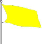
2/18/11, 12:30pm - City Issues Yellow Flag Alert
2/15/11, 4:40pm - City Issues Green Flag Alert
Please note that during the summer I lost my hard drive, and at that time I lost the database of folks that had requested to receive alerts regarding mud updates from SierraMudre.info. If you were on that list, please note that you will not receive notices unless you re-sign up to receive notices. My apologies for any inconvenience.
|
.JPG)
City and County Alerts/Releases
2/18/11, 12:30pm - City of Sierra Madre Issues Yellow Flag Alert
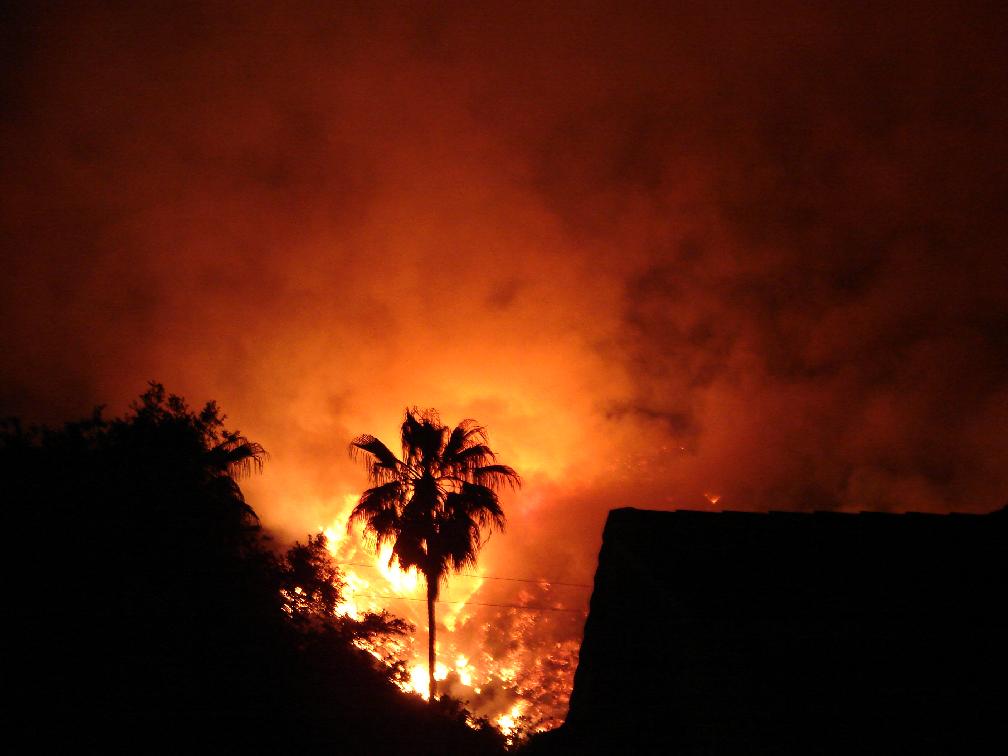
The City of Sierra Madre has
issued a Yellow Flag Alert today. The County of Los Angeles Public Works
Department has issued a Phase 1 Mudflow Forecast. A Phase 1 indicates that
small isolated debris and mudflows are possible at specific locations.
Streets may be flooded or blocked by debris. Woodland Drive, Skyland Drive, and
other streets may be closed due to blockage. Should debris flows occur
overnight, crews will begin clearing the following morning.
Parking restrictions are now in effect in the Upper and Lower Canyon during
Yellow or Red Flag alerts. Vehicles parked on the streets may be towed at
owner’s expense.
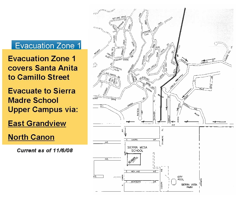
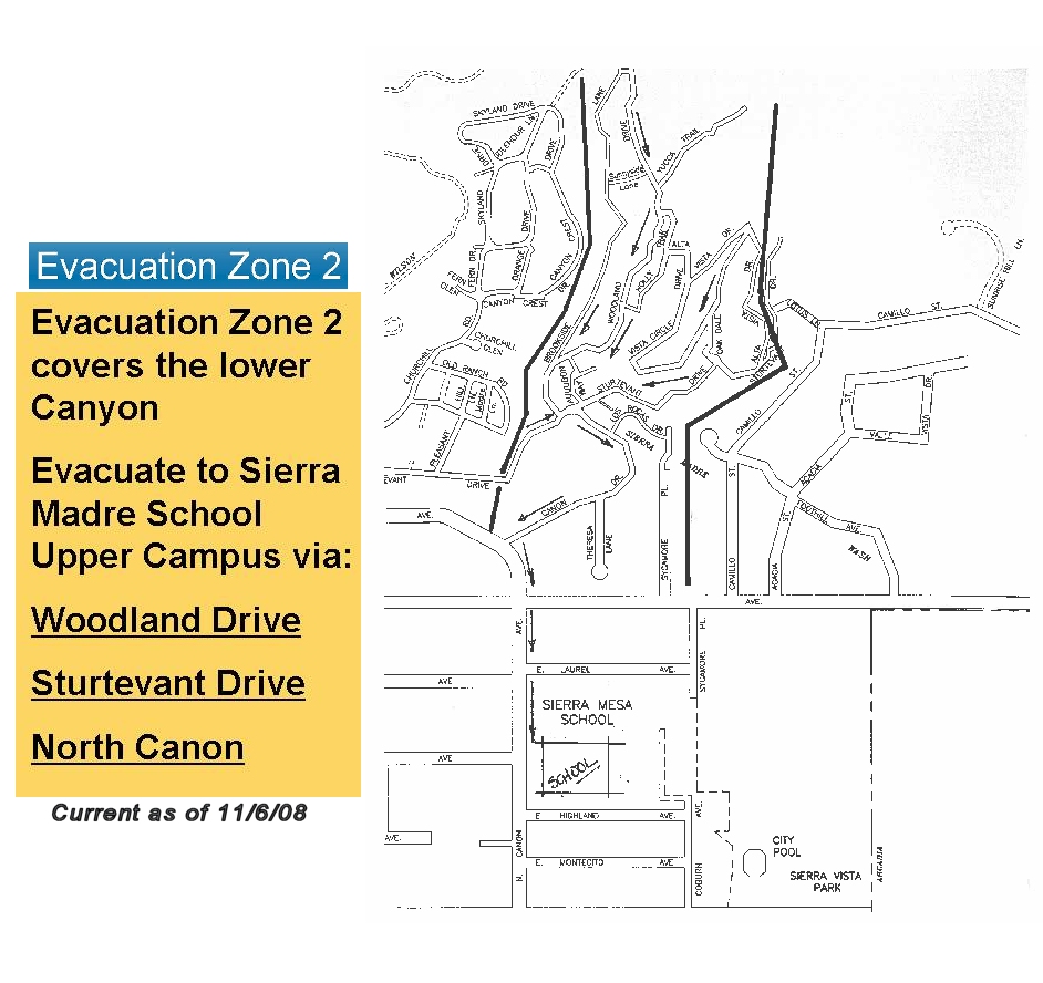
The affected streets are: Mount Wilson Trail, Churchill Rd., Skyland Dr., Fern
Glen, Fern Dr., Idlehour Ln., Canyon Crest Dr., Orange Dr., Woodland Dr.,
Brookside Lane (upper, middle, and lower segments), Sunnyside Lane, Sturtevant
Dr., and Yucca Trail. Overnight parking restrictions through the rest of the
city are lifted during Yellow or Red Flag Alerts.
The City Public Works Department may determine that Upper Brookside Lane and the
very northern portion of Woodland Drive will be closed and a temporary debris
wall will be erected.
Residents in the affected areas are urged to be "set" to leave at a moment’s
notice and may choose to voluntarily evacuate. In the event the City receives a
Phase 2 or Phase 3 alert from the County, a Red Flag Alert will be issued that
will most likely include mandatory evacuation orders. Evacuated residents will
not be allowed to return into an evacuation area until the order is lifted.
For additional information and updates:
PHONE: City Hall - 626-355-7135 (business hours 7:30am – 5:30pm)
Police Dept - 626-355-1414 (non-emergency, 911 for emergencies)
City Website (http://www.cityofsierramadre.com/)
SMTV3, (channel 3 on Time Warner Cable)
Sierra Madre Emergency Blog (http://www.sierramadrepio.blogspot.com/)
Community Radio – AM 1630
Email Alerts “eBlasts” – Register to receive email notices by clicking the link
on the City’s website homepage.
City of Sierra Madre Issues Green Flag Alert
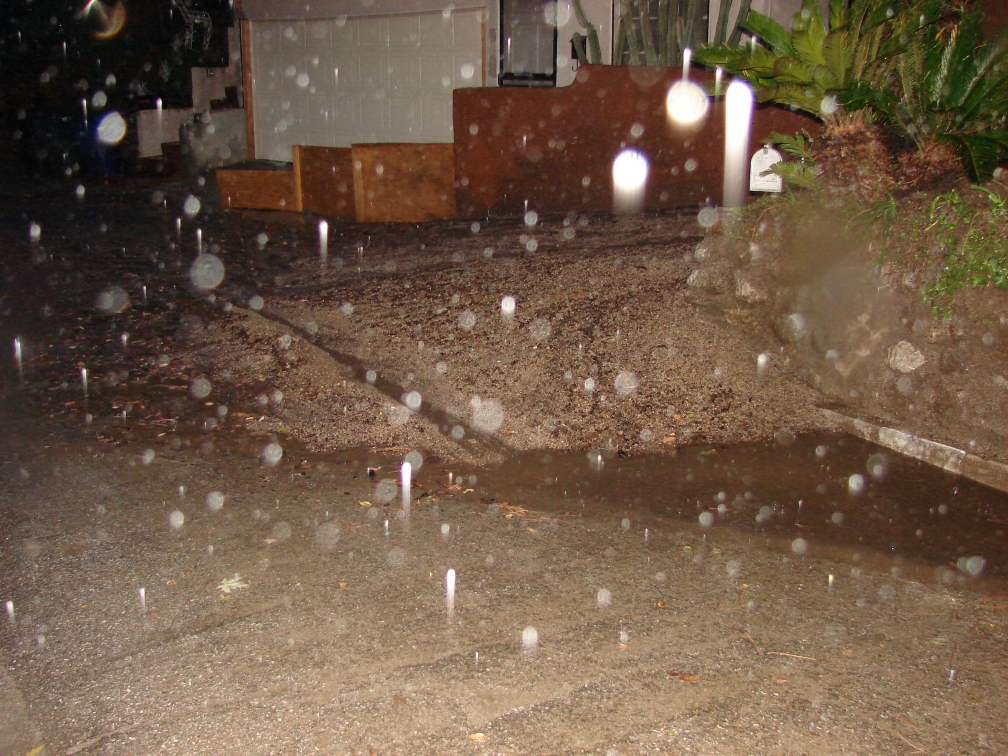
The City of Sierra Madre has issued a Green Flag Alert for mudslides and debris
flows in the hillside communities. The National Weather Service has forecast a
100% chance of precipitation beginning tomorrow, Wednesday, February 16, 2011.
A Green Flag Alert is issued when there is an 80% chance or more of
precipitation. Affected residents should get ready for potential evacuation and
keep close watch on weather forecasts. This includes residents of the Upper and
Lower Canyon as well as any resident whose property abuts the hillsides.
As we are in the midst of the rainy season, City Officials would like to remind
residents of our mud and debris flow alert system.
A series of three different colored flags will be flown at four different
locations in the City (City Hall, Search and Rescue Station, Mountain Trail at
Churchill Road, and Mary’s Market). When possible, flags will be displayed
indicating one of three stages of emergency. Be sure to check the website, email
alerts, SMTV3, AM 1630, or simply call City Hall or the Police Department to
confirm the current stage of emergency and please understand the City may not
always have the ability to change these flags the moment conditions or forecasts
change.
The City has identified a number of streets that will need to be clear of all
vehicles during a Yellow Flag or Red Flag alert. The affected streets are: Mount
Wilson Trail, Churchill Road, Skyland Drive, Fern Glen, Fern Drive, Idlehour
Lane, Canyon Crest Drive, Orange Drive, Woodland Drive, Brookside Lane,
Sturtevant Drive, Sunnyside Lane, and Yucca Trail. The Yellow and Red Flag
Alerts will trigger vehicles being towed from these streets at the owners’
expense.
Stage One: GREEN FLAG - Activated under a prediction of 80% - 100% chance of
precipitation. Affected residents should get “READY” for potential evacuation.
This includes keeping a close watch on weather forecasts.
Stage Two: YELLOW FLAG - Activated with an LA County Phase 1 mudflow forecast.
This is described as small, isolated debris and mudflows possible at specific
locations. Affected residents should get “SET” to leave their homes and may
choose to voluntarily evacuate. Please note that all vehicles must be off the
streets in potential mudflow areas during Yellow Flag alerts.
Stage Three: RED FLAG - Activated with an LA County Phase 2 or 3 forecast. Phase
2 includes moderate debris and mudflows at more widespread locations. Phase 3 -
the potential exists for significant debris and mudflows to be widespread.
Affected residents should “GO”, meaning they should immediately evacuate, and
vehicles should not be parked on the streets.
When evacuating, please plan to be as self-sufficient as possible with important
paperwork, medications, and clothing for at least seven days. It is important
anticipate a possible evacuation order, and make plans for your pets in advance.
Please note that Public Safety Officials do not take evacuation orders lightly
and residents should heed these orders. Once mud begins to flow, Emergency
Responders will NOT rescue those who failed to evacuate until the mud has
stopped flowing and it is safe for responders to enter the mud flow areas.
For more information about mudslide and debris flow preparations, please visit
www.cityofsierramadre.com and click “Emergency Preparedness Information” and on
the home page. Updates will also be issued on SMTV3 (Time Warner-channel 3),
Sierra Madre Community Radio (AM 1630), and the City’s Emergency Blog (http://sierramadrepio.blogspot.com).
** Regarding both the SierraMudre.Info website and its alert notice e-mail list - While we will do our best to post alerts and send e-mail notices in a timely manner, there are many reasons why we may not be able to send e-mail alerts and/or update the website when notices are received. SierraMudre.Info and SierraMadreNews.net are basically one-person operations. If I am out patrolling the area, or working, or out of town, or just out of the office, or away from my computer for any reason, I may not be aware that an alert has come in. SierraMadreNews.net and SierraMudre.info offer this website and the e-mail alert program as a public service, and accept no responsibility for the passage of time between alerts arriving in our office and the posting on our site or the sending of an alert by our program. By signing up for this e-mail alert program, you are acknowledging that you recognize that alerts may not be sent in a timely manner, and agree to hold harmless and indemnify SierraMadreNews.net, SierraMudre.info, The Coburn Group and Bill Coburn in the event of any damage or harm caused by storms, mudflow and debris. E-mail notices will be sent when we post notices that we have received alerts regarding potential mudflow or change in storm alert status from any government agency, i.e., the City of Sierra Madre, Los Angeles County, Los Angeles County Dept. of Public Works, etc. For OFFICIAL news and information, visit the City's emergency blog: http://sierramadrepio.blogspot.com SIGN UP FOR THE SIERRAMUDRE.INFO E-MAIL ALERT NOTICE PROGRAM